Marble
Appearance
Αρχική » Εφαρμογές » Εκπαίδευση » Marble

|
Το Marble είναι μια πανίσχυρη εικονική υδρόγειος και παγκόσμιος χάρτης. Αποτελεί τμήμα του Εκπαιδευτικού Προγράμματος του KDE. |

Για μια σύντομη εισαγωγή στο Marble μπορείτε να ρίξετε μια ματιά στις
σελίδες παρουσίασης του Marble στο Akademy / GCDS 2009.
Επίσης, υπάρχει και το YouTube βίντεο των 10 πρώτων λεπτών. Το πλήρες βίντεο μπορείτε να το κατεβάσετε από εδώ.
Features
- You can pan and zoom around and you can look up places and roads
- A mouse click on a place label will provide the respective Wikipedia article
- You can measure distances between locations
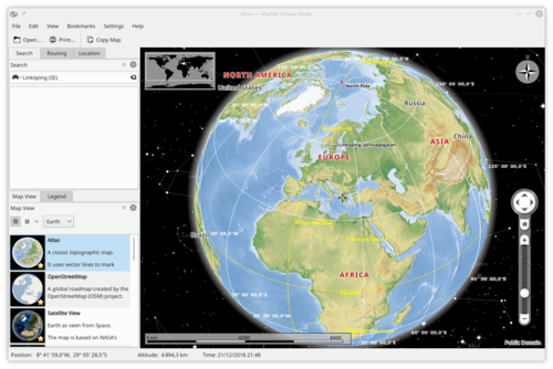
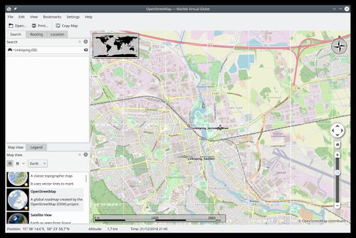
- It offers different thematic maps: A classroom-style topographic map, a satellite view, street map, earth at night and temperature and precipitation maps. All maps include a custom map key, so it can also be used as an educational tool for use in class-rooms
- For educational purposes you can also change date and time and watch how the starry sky and the twilight zone on the map change
- Supports multiple projections: Choose between a Flat Map ("Plate carré"), Mercator or the Globe
- Promotes the usage of free maps
Screenshots

