KGeography/da: Difference between revisions
(Importing a new version from external source) |
(Importing a new version from external source) |
||
| Line 4: | Line 4: | ||
{|class="tablecenter vertical-centered" | {|class="tablecenter vertical-centered" | ||
| [[Image:Kgeography.png|64px]] | | [[Image:Kgeography.png|64px]] | ||
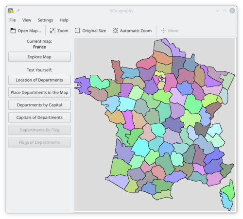
| '''KGeography''' | | '''KGeography''' er et undervisningsprogram til geografi, hvor du kan lære om den politiske opdeling af nogle lande (inddelinger og deres hovedstæder og eventuelle flag)<br /> | ||
Det er en del af [http://edu.kde.org KDE Education Project]. | |||
|} | |} | ||
Revision as of 07:05, 7 October 2010
Hjem » Programmer » Uddannelse » KGeography

|
KGeography er et undervisningsprogram til geografi, hvor du kan lære om den politiske opdeling af nogle lande (inddelinger og deres hovedstæder og eventuelle flag) Det er en del af KDE Education Project. |

Features
- Learning by browsing the maps clicking in a map division to see its name, capital and flag
- Learning in game modes:
- The game tells you a map division name and you have to click on it
- The game tells you a capital and you have to guess the division it belongs to
- The game tells you a division and you have to guess its capital
- The game shows you a map division flag and you have to guess its name
- The game tells you a map division name and you have to guess its flag
- The game shows an empty map and you have to place divisions on it one by one
Documentation
Weblinks
- KGeography website at berliOS.de (english)
